Have you ever planned great social studies and science lessons but run out of time to teach them both? I have. I love teaching both social studies and science because they offer opportunities for creativity and project-based learning.
How do we fit both science and social studies in? Even though I've spent time planning out the school week and the agenda is both printed and posted online, I sometimes can't get to it all and feel frustrated. It is hard to fit in significant time for both science and social studies.
I have found a way to teach 4th graders about the science of topographic maps while teaching the social studies unit on regions of California!
Natural wonders shape the Golden State and these activities give 4th graders a taste of each of the regions of California (history standards) WHILE learning about topographical maps (NGSS). We have so much to teach so integrating subjects and standards saves time and enriches learning.
Give your 4th grade students experience with real online topographical maps and data with this one-of-a-kind resource that includes:
- 4th grade social studies and science vocabulary
- Links to videos
- Informational text about each of the four regions of California
- A graphic organizer of the four regions of California
- Digital and print project page for one of California's regions
- Writing prompts
- A California topography scavenger hunt
- A population graph
- Digital and print quizzes
 |
Seamlessly integrate the following standards with hands-on activities and interactive learning opportunities:
- NGSS 4 ESS2-2 Analyze and interpret data from maps to describe patterns of Earth’s features.
- CA History 4.1
- 3. Identify the state capital and describe the various regions of California, including how their characteristics and physical environments (e.g., water, landforms, vegetation, climate) affect human activity.
- 4.Identify the locations of the Pacific Ocean, rivers, valleys, and mountain passes and explain their effects on the growth of towns.
- 5.Use maps, charts, and pictures to describe how communities in California vary in land use, vegetation, wildlife, climate, population density, architecture, services, and transportation.
Unearth California's Topography and Regions in 4 Engaging Activities
1. Introduce the Concept of Topographical Maps:
Begin by explaining what topographical maps are and how they represent the elevation and physical features of a particular area. Teach 4th grade map skills using simple language and visual aids to illustrate the basic elements of a topographical map, such as contour lines, symbols, and legends.
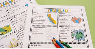
This resource includes 4th grade science and social studies vocabulary worksheets with simple explanations and clear graphics to help teach map skills.
 |
| Topographic Map Vocabulary |
.jpg) |
2. Dive into California's Regions:
Are you looking for project ideas for California's regions? California is a state blessed with diverse landscapes and regions, making it an ideal case study for teaching topography. Introduce students to the four major regions of California. Provide clear visual representations of each region and emphasize their unique geographical characteristics, such as mountains, rivers, deserts, and coastal areas. This California region project is available in digital and print.
There is a one-page informational social studies worksheet for students to read about each region. Students can use this information to create their digital or print project about one of California's regions. Teach map skills with a simple map where students label nearby states, the capital Sacramento, and each of the four regions of California.
3. Hands-on Mapping Activities:
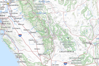
While completing a topographical map scavenger hunt, students will zoom in and out while discovering lakes, rivers, and mountaintops. The topographical scavenger hunt uses https://topobuilder.nationalmap.gov/ and helps students explore Catalina Island, Yosemite National Park, and Death Valley.
 |
| USGS Topographic Maps of Well Known Areas of CA |
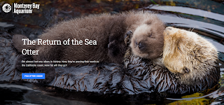
While physical field trips might not always be feasible, virtual field trips offer a fantastic alternative. Utilize online resources, such as interactive websites or virtual reality platforms, to take students on virtual tours of different regions of California. Show them breathtaking images, videos, and 360-degree panoramas that bring the landscapes to life. Here is a Google Earth Voyager activity about sea otters that shows the beautiful California coast. Link HERE.
Make learning fun and interactive while encouraging students to explore, ask questions, and develop their own curiosity about the world around them. See the full preview HERE on TPT.


